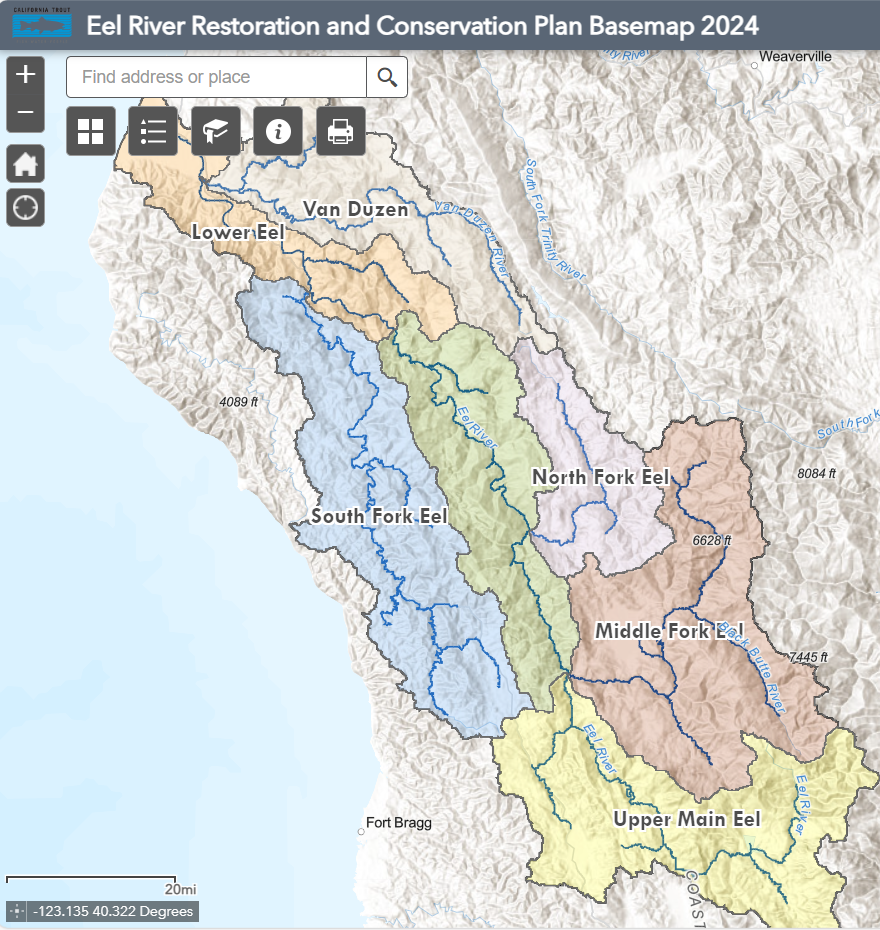
Eel River Restoration and Conservation Plan Basemap 2024
Click on the map link above to use the Eel River watershed interactive web map tool. Within the tool you can click on and off data layers, view other preliminary data created by the Eel River Restoration and Conservation Plan project team, and overlay landscape scale data within your project area. After customizing the map to your work area, you can also print or save a PDF of the map layers that you chose to view by clicking on the printer widget.
Web map created by Christine Davis 2024
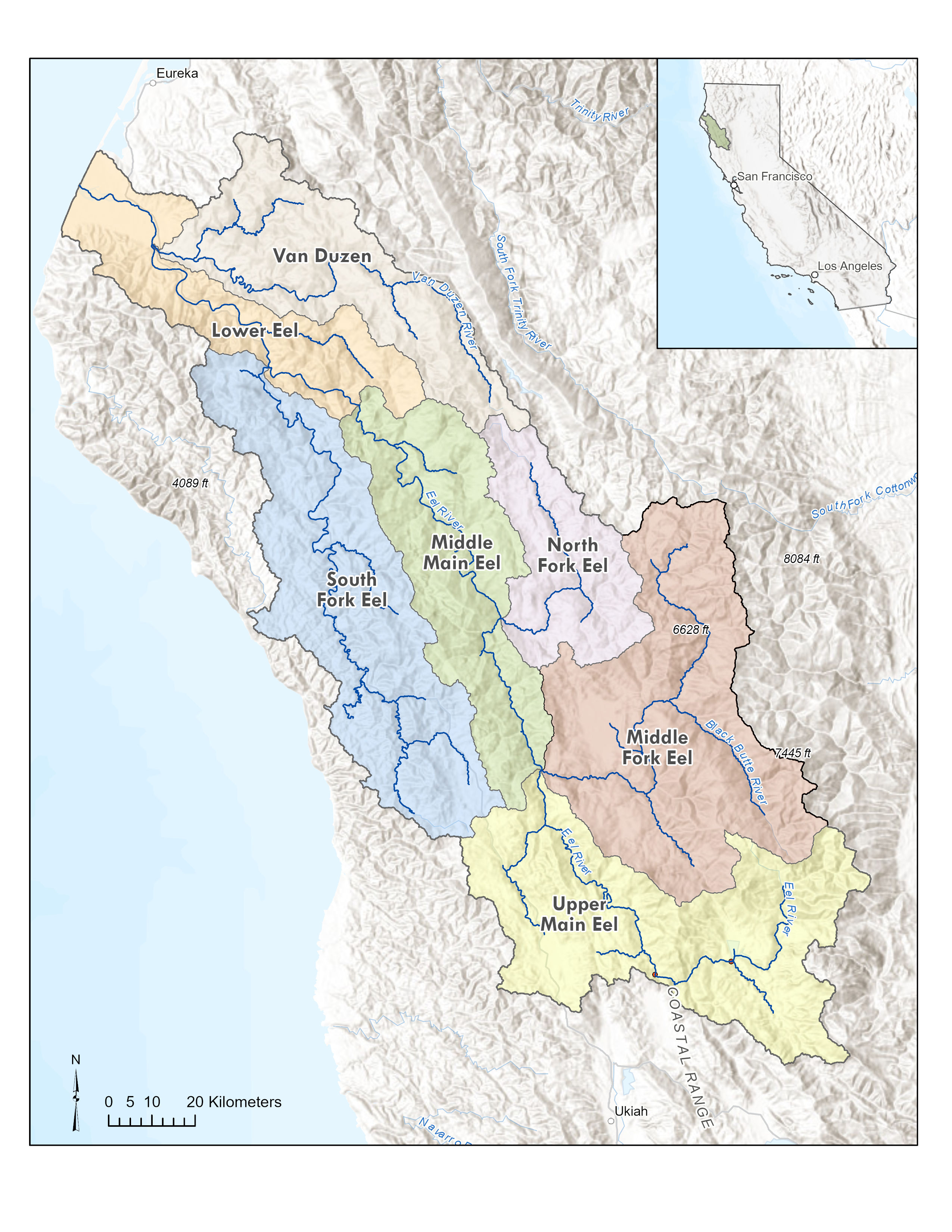
Potential Riparian Area
Mapping ‘Potential Riparian Area’
Instead of using standardized buffers to map riparian areas (For example, 100 feet from the center of the river channel), CalTrout worked with Stillwater Sciences in 2024 to develop a Potential Riparian Area (PRA) spatial dataset using a geomorphons approach from Digital Elevation Model. This method defines riparian area restrained by slope and valley bottom and attached to the National Hydrography Data (NHD). Mapping riparian area potential is useful because this method includes annual and intermittent streams as potential riparian area. Many streams in The Eel River watershed do not have continuous flows through the summer and dry periods, but rather provide important habitat for fish and other species intermittently.
The Potential Riparian Area data is downloadable as a shapefile and can be used to define potential area for riparian studies. The Upper Main Eel River sub watershed is highlighted in the map to show the focal area where these data are being used by local researchers and California Trout to review potential restoration areas pre and post Potter Valley Project dam decommissioning.
Created with a geomorphons method by Stillwater Sciences and California Trout 2024.
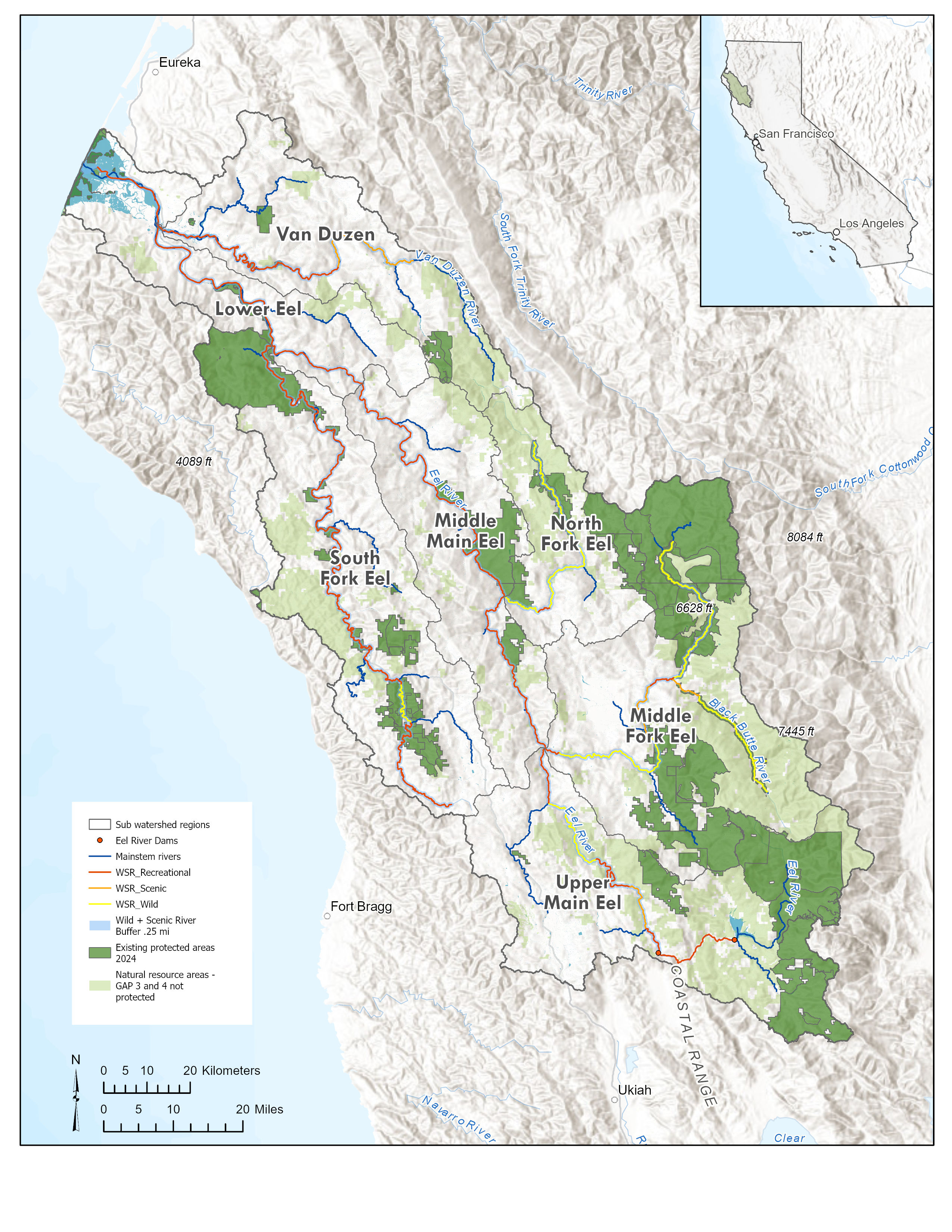
Eel River Basemap with protected areas and Wild and Scenic River designations.
Eel River Basemap, with protected areas GAP 1 and 2, other natural resource areas GAP 3 and 4, and Wild and Scenic River designation levels.
Map created by Christine Davis 2024
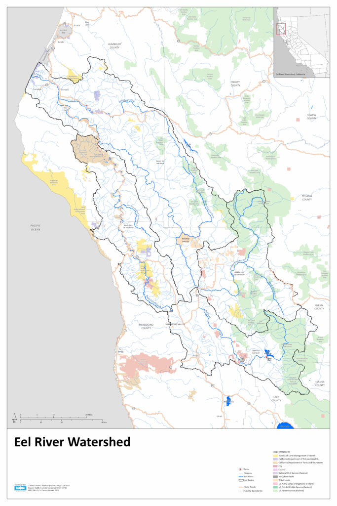
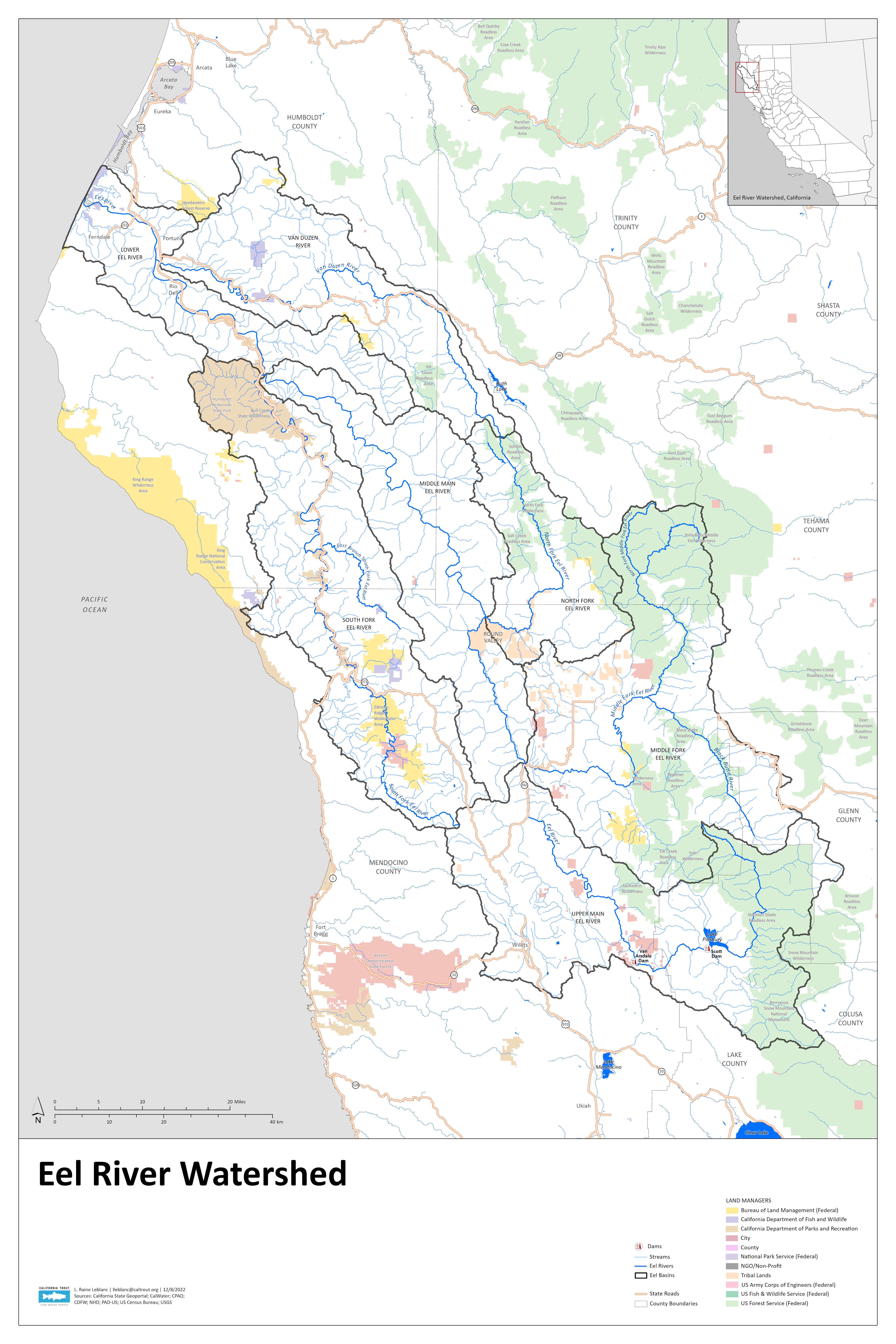
Wall map of the Eel River watershed
Official CalTrout Eel River watershed map, created by Raine LeBlanc 2022.