This page provides data downloads for spatial data products created or compiled in support of the Eel River Restoration and Conservation Program.
Note that clicking on any of the links below will immediately begin the download process to your computer.
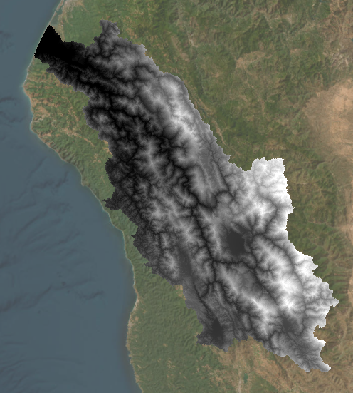
Eel River watershed digital elevation model (DEM)
The Eel River watershed digital elevation model (DEM) can be used as a basis to build other spatial data products. For example, this DEM was used for developing the Potential Solar Radiation data, and the Potential Riparian Area layer with the geomorphons method.
Format: TIFF
Resolution: 30 meters
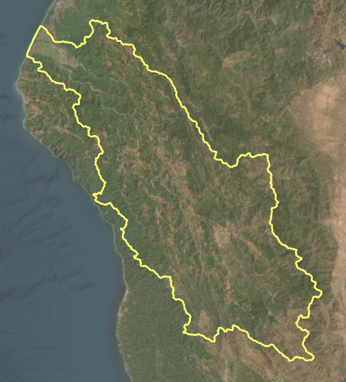
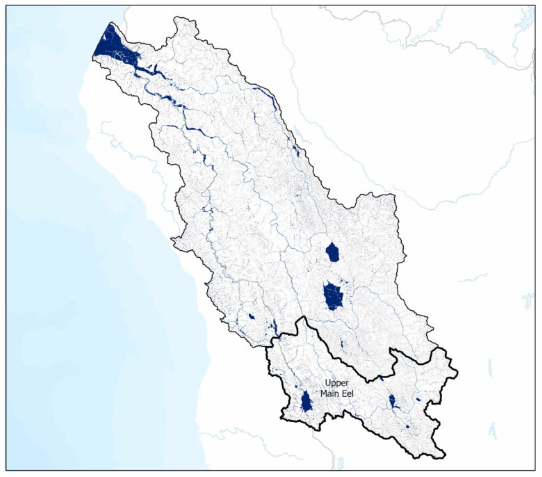
Eel River watershed boundary
Boundary of the area that contributes water to the Eel River. The boundary aligns with the HUC 12 level sub watersheds in the Eel River watershed.
Format: Shapefile
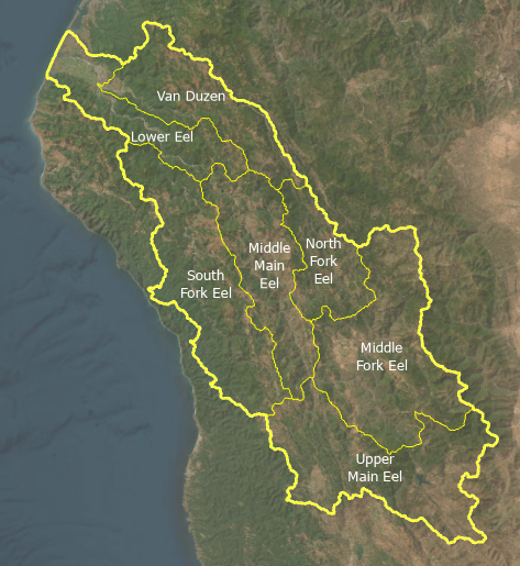
Eel River watershed sub watersheds
The Eel River watershed sub watersheds shapefile is derived from Calwater sub watershed divisions, but with actual boundaries matching those of the USGS HUC 12 boundaries. These align with HUC 12 boundaries of the Eel River watershed. Created by Christine Davis for California Trout 2024.
Format: Shapefile
Solar Radiation for Northwestern California
Calculation of monthly mean solar radiation.
Modeled solar radiation data for northwestern California. Solar radiation is relatively constant from year to year, thus one year of rasters are provided. The region defined is within the boundary of the CalTrout North Coast Region boundary. Created by Jim Graham, CPH 2024.
The daily global radiation in Megajoules per meter squared (MJ/m2) was computed using the equations provided in Physical Hydrology, 3rd Edition, by Dingman. Specifically, equation D-28 in Appendix E provides the equation for Total Indecent Radiation at the Surface. This equation is based on equations for direct radiation hitting a sloped surface, diffuse radiation in the atmosphere, and backscattered radiation. All equations are described in Dingman, 2002. The slope of the surface was provided by a digital elevation model (DEM).
The calculation was implemented in BlueSpray, a Java-based application for creating geospatial transforms. The initial solar radiation calculation was added as a class name STSolarRadiation. Another class, STSolarDailyRadiationRaster was created to generate the mean daily rasters with solar radiation values. Both tools are available in BlueSpray by loading a raster file with a DEM, right clicking on the DEM, and selecting “Solar Radiation” or “Solar Radiation Daily Raster”. The program was developed in NetBeans using Java version 21.
Special code was added to STSolarDailyRadiationRaster to general the monthly mean rasters. These files were saved as “Tagged Image File Format” (TIFF) files. The calculations and then the final outputs were verified against the “SolarRad.xlsx” spreadsheet provided at waveland.com/Dingman.
Format: TIFF
Resolution: 30 meters
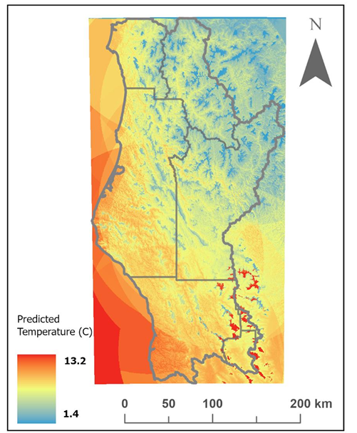
Temperature Data for Northwestern California
Air temperature data. Each of the links below will download a zip file with rasters for each month of the specified year. The rasters contain the mean monthly temperature for the area corresponding to each pixel. Created by Farrah Tyler, CPH 2024.
Format: TIFF
Resolution: 30 meters
Report and methods: North_Coast_Temperature_Modeling.pdf
Potential Riparian Area (PRA) shapefile
Potential riparian area based on the digital elevation model. Used for analysis and decision making to guide restoration and conservation of potential riparian areas. Analysis and shapefile created by Stillwater Sciences for California Trout, March 2024.
Format: Shapefile
Report: Geomorphon methods for deriving potential riparian area
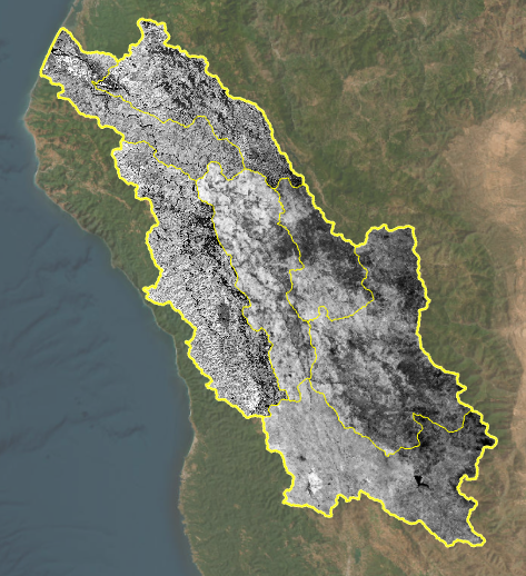
Normalized difference vegetation index (NDVI)
Format: TIFF
Report: NDVI Analysis for the Eel River watershed
Each of the files below contains NDVI data for each of the main sub watersheds within the Eel River watershed.